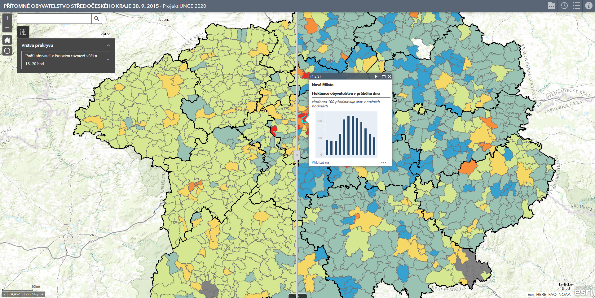
Present population in Prague and municipalities of the Central Bohemian Region
(30. 9. 2015)
The map application focuses on the issue of the present population and its everyday changes in the municipalities of the Central Bohemian Region and the cadastres of Prague. The innovation lies in the use of localization data of mobile phones for capturing spatiotemporal changes. In application are shown the numbers of persons present in two-hour intervals in spatial units, the ratios between persons present in different parts of the day and the typology of municipalities and cadastres. The map application therefore actually shows us which municipalities and cadastres serve purely as residential and which also have a work or service function for their residents, but also from the wider area.


