Zones of residential suburbanization in Czechia
(2010 – 2016)
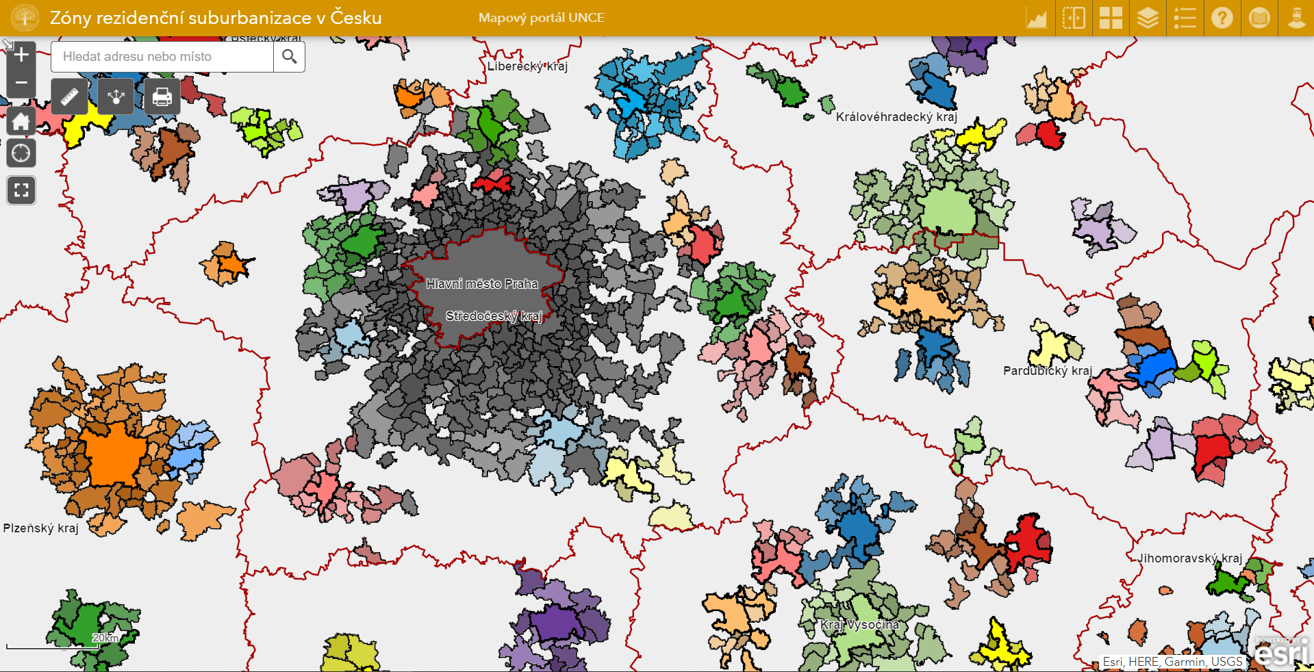
The main goal of this map application is to give the user a sense of the extent and importance of the process of residential suburbanization in Czechia, with the help of an original methodology of its delimitation at the municipal level. We use data from the most recent delimitation of suburban zones, which took place in 2016, and for comparison also the older one from 2010. Interactive layers make it possible to determine the affiliation of individual municipalities to suburban cores as well as see the intensity of the suburbanization process represented by classification into individual zones. Furthermore, the application contains additional layers documenting housing construction and migration flows, i. e. phenomena explicitly related to the process of suburbanization, and at the same time serving in the mentioned methodology as one of the determining indicators.