Water quality and pollution in sediments of the Elbe River oxbow lakes
(2007 – 2017)
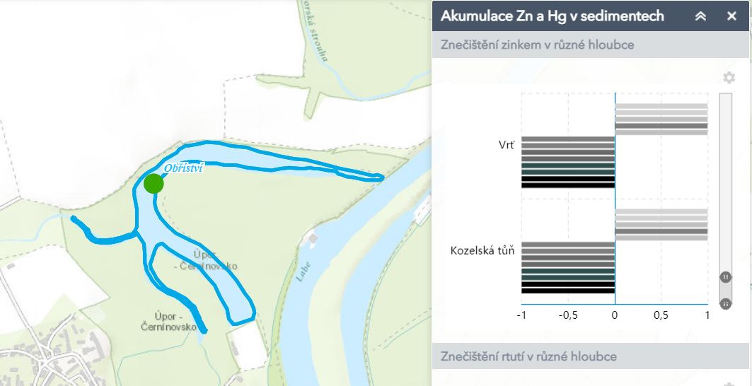
This map application shows water quality and anthropogenic pollution in sediments of the Elbe River oxbow lakes. Each concentration is shown as the class of water quality according to ČSN 757 221. It is possible to see more details, graphs and description of measured parameters in pop-up windows. The application also displays the anthropogenic pollution in sediment. The concentration in each depth is available as the class of the Index of Geoaccumulation. This index means the rate of pollution in sediment in each parameter. The user can choose the depth layer of analysed sediments. It is also possible to see more information about graphs of concrete concentration, its development in depth layers, description of measured parameters and its influence on health of population. At majority of localities in the middle stream of the Elbe River, the contaminated sediments of the oxbow lakes represent old anthropogenic loads, which can be remobilized during floods, and this material can represent a secondary source of pollution.